
Ocoee River Corridor
Hiking Trails
Hiking in Cherokee National Forest
Hiking in the Ocoee River Corridor area offers over 600 miles of incredible trails in the Cherokee National Forest in southeastern Tennessee. This gem of a recreation area spans over 650,000 acres, with trails for hikers of all skill levels. The forest boasts diverse landscapes, ranging from dense woodlands filled with towering trees to cascading waterfalls that provide a serene backdrop. Hikers could encounter abundant wildlife like deer, black bears, and various bird species. The most popular trails include the Tanasi Trail System, the Chilhowee Trail System and Chilhowee Recreation Area, the Benton McKaye Trail, and waterfall hikes like Benton Falls (in Chilhowee Recreation Area). A leisurely scenic hike and picnic is a wonderful addition to your Ocoee whitewater rafting getaway!
Want to learn more about the wonderful hiking in the area? The Ocoee River State Park is an incredible resource for hiking, camping, park activities, and information. The Hiwassee Park Rangers are knowledgeable about the area and love to educate guests.
Quick Info
- Over 600 miles of hiking trails
- Benton McKaye Trail - 300+ miles
- Appalachian Trail - easy access from Hwy 64
- Tanasi Trail System
- Chilhowee Trail System and Recreation Area
- Easy Ocoee River trails at Tanasi
- Great for day and multi-day hiking trips
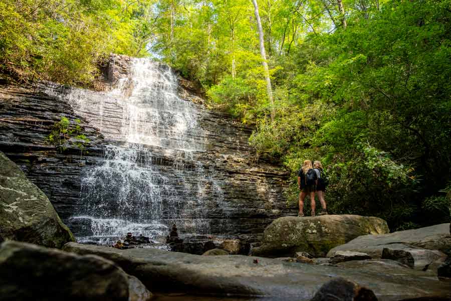
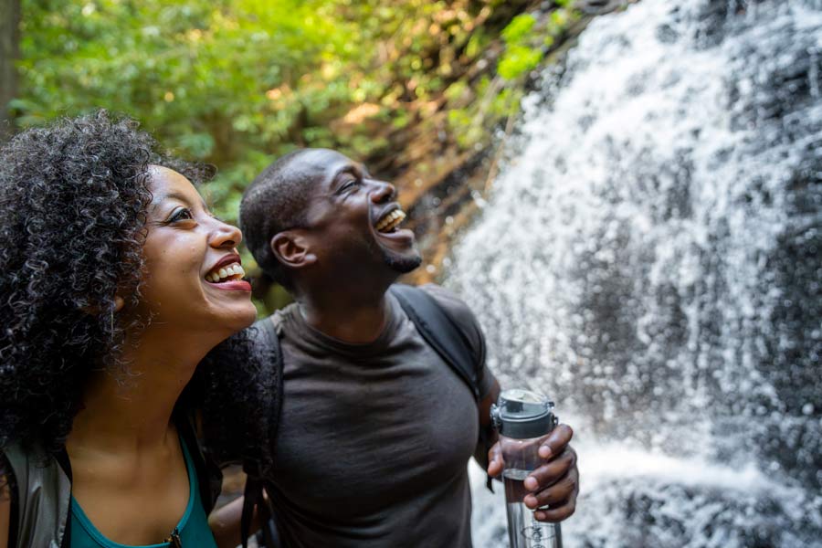
Benton Falls
Put on your walking shoes and explore the beauty of the 65-foot waterfall, Benton Falls, with friends and family by setting off on a 3.2-mile trek through the Cherokee National Forest. Located in Chilhowee Recreation Area, you must remember to bring $3 cash to pay the day-use fee when you start at the parking lot. Take a left at the trailhead and continue along the lake until you see a sign pointing left for Benton Falls Trail No. 131. After hiking 1.5 miles, look for a sign that reads “Benton Falls,” then take a left and follow stone steps down to reach the 65-ft waterfall’s base. Enjoy its breathtaking sights before backtracking along the same path to return to the starting point after your incredible journey.
- Chilhowee Recreation Area, near Benton, TN
- 3.2 mi / 318 ft gain - Out & Back
- $3 day-use parking fee
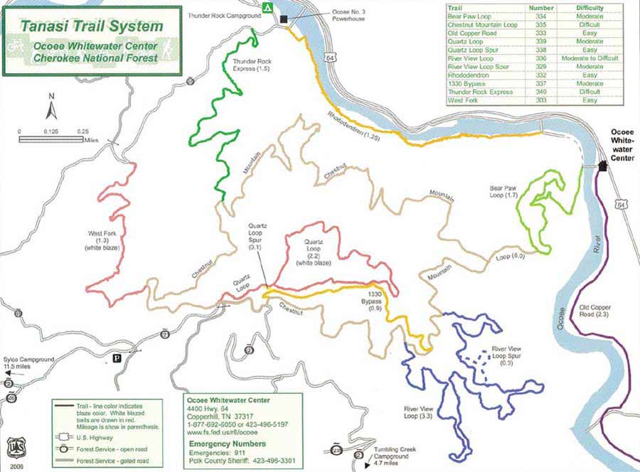
Tanasi Trail System
Cherokee National Forest offers a unique hiking experience with its varied terrain and breathtaking scenery. The Tanasi Trail System, accessible from the site of the Ocoee Whitewater Center on Hwy 64, is one of the best. (The Ocoee Whitewater Center burned down in 2022, so no facilities are open and no parking is available at the Center.) Named after the Native American village that once thrived here, the Tanasi Trail System of over 20 miles has 7 different trails from easy to challenging, including the Old Copper Road that follows along the Upper Ocoee River. Download a useful map of the Tanasi Trail System courtesy of Tennessee Overhill.
- Ocoee Whitewater Center, Copperhill TN
- Over 20 miles of trails hiking and biking
- Free parking at the Upper Ocoee Olympic section
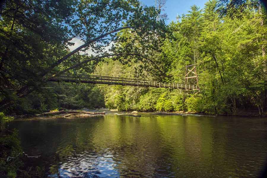
Benton McKaye Trail
The Benton McKaye Trail travels right through the Ocoee River Corridor. This lesser-known “sister trail” to the famous Appalachian Trail is a gem that starts in Georgia and travels over 300 miles through Tennessee and North Carolina into the Great Smoky Mountains National Park. It is currently being recommended to become a National Scenic Trail. You’ll find incredible views, no crowds, and will cross the Ocoee River on the trail.
- Crosses the Upper Ocoee River at Thunder Rock CG
- Remote Wilderness & Scenic Views
- Parking at Upper Ocoee Olympic Section on Hwy 64
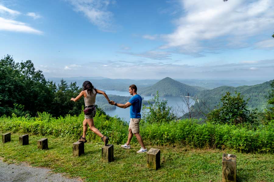
Chilhowee Trail System
The Chilhowee Trail System offers over 20 miles of outstanding hiking and biking trails in Cherokee National Forest, starting from the northeast edge of Parksville (Ocoee) Lake at Parksville Campground off Hwy 64, and going all the way up Chilhowee Mountain to the scenic Chilhowee Recreation Area at the top. Hikers can swim and picnic at McKamy Lake at the top. Trails vary in difficulty. The lake-area trails are great for younger kids. Breathtaking vistas of Parksville/Ocoee Lake and Ocoee River and distant mountain ranges reward hikers at the top of Chilhowee Recreation Area.
- Chilhowee Recreation Area & Parksville Campground, near Benton, TN
- Waterfalls & Scenic Vistas
- Popular Benton Falls Hike is in Chilhowee
More Waterfall Hikes:
Goforth Creek – 3.7 miles: This dog-friendly, out-and-back hike near Turtle Town is a moderate-to-challenging trail with a lovely babbling creek and waterfall. This trail can have some overgrowth and fallen trees, so keep that in mind with small children.
Gee Creek Falls – 2.7 miles: This dog-friendly, out-and-back hike near Delano, TN, is a moderate-to-challenging trail. The first 2/3 of the trail is easy to tackle, while the last 1/3 requires some scrambling and climbing to reach the final view of a beautiful waterfall that changes personality with the seasons. This fall can look like two twin cascades or a full curtain of gushing water, depending on water levels.
Turtletown Falls – 5.2 miles: This out-and-back hike near Farner, TN, is a moderate-to-challenging trail. This trail can be slippery and hard to follow, so we recommend wearing hiking boots and downloading a map. There are multiple falls to enjoy along the route.
Conasauga Falls – 1.3 miles: This out-and-back hike near Tellico Plains, TN, is considered a moderate trail. These falls are stunning and have a little swimming hole at the base to cool off.
- Waterfalls & Scenic Vistas
