The Ocoee River Corridor, set in the picturesque Appalachian Mountains in southeast Tennessee, is packed with fun, including whitewater rafting, mountain biking, hiking, fishing, boating, and swimming. It is known as America’s favorite whitewater, but did you know that it is one of the most affordable outdoor destinations for authentic family and friends adventure getaways, too?
The Ocoee River actually starts in Georgia but it is named the Toccoa River there. It’s name changes to the Ocoee River when it crosses the GA/TN state line. The Ocoee river continues until it meets the Hiwassee River, which flows into the Tennessee River.
The Tennessee Valley Authority regulates the Toccoa and Ocoee Rivers with multiple dams that guarantee consistent, warm water releases all season long, making the Ocoee River Corridor a spectacular adventure destination.
There are many activities suitable for everyone in your group. Love action? Go whitewater rafting on the Upper or Middle Ocoee River sections. Want to explore the lush forest? Cherokee National Forest has over 100 trails suitable for hiking or birding. The Tanasi Trail System has exceptional biking and hiking trails that follow the Ocoee River. Want to cast a line? Wild trout, rainbow, brown, and native brookies are present in most mountain streams. Looking for a relaxing float trip? The Toccoa or Hiwassee has you covered. The Ocoee River Corridor offers a diverse range of activities and experiences to suit any interest.
Quick Info
93 miles of river fun
Sections of the river run through Cherokee National Forest
100s of hiking trails in Chilhowee Recreation Area
Tanasi Trail System mountain bike trails for all abilities
Well-stocked streams
Exciting whitewater rafting
Relaxing kayaking and paddleboarding available
Parksville (Ocoee) Lake - great for swimming, fishing, beaches, picnics, boating
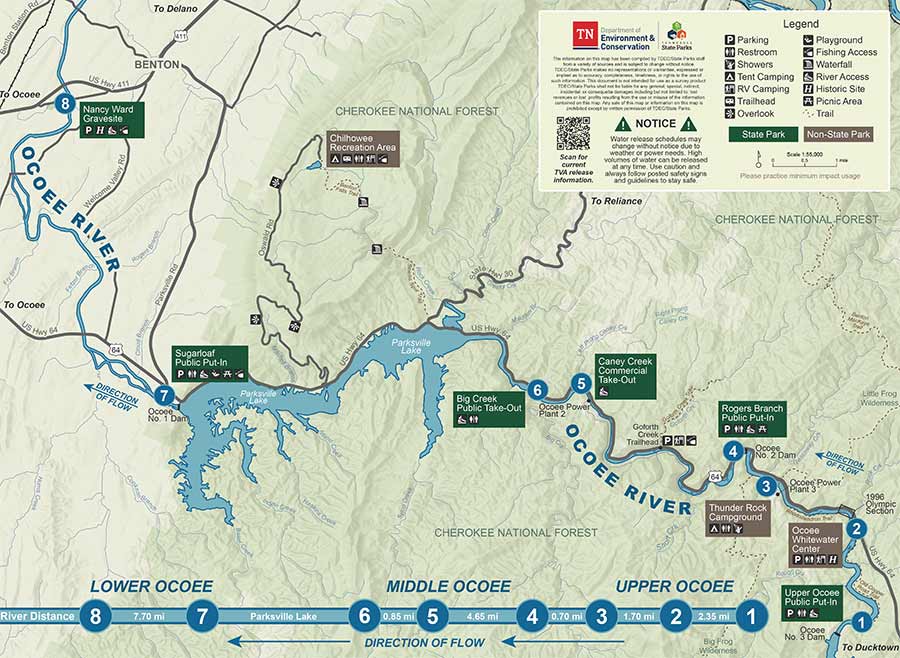
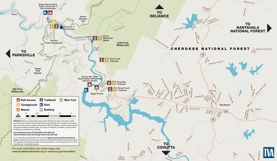
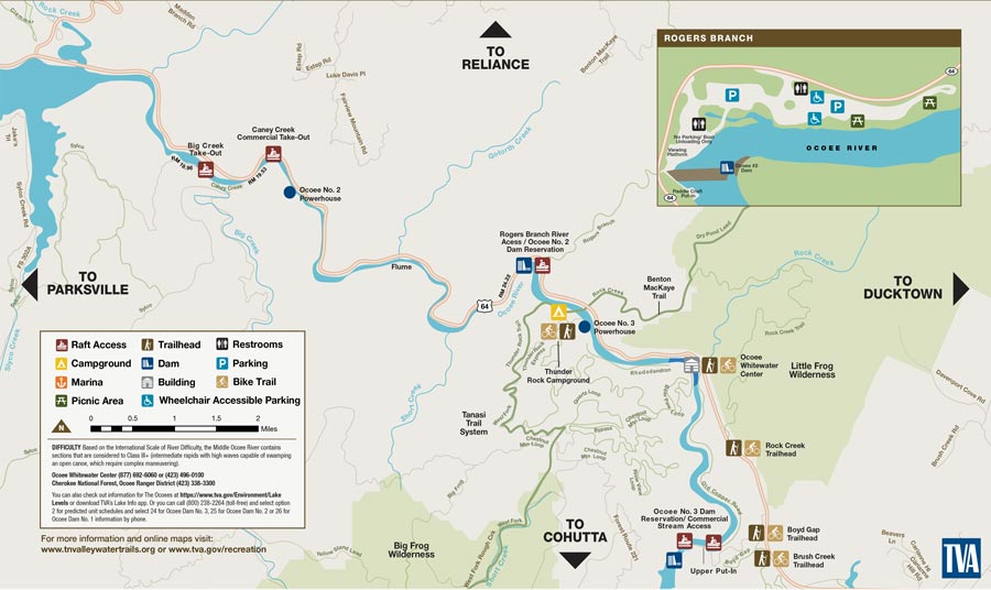
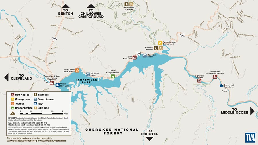
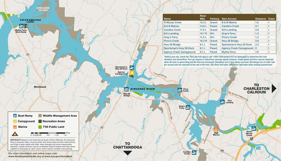
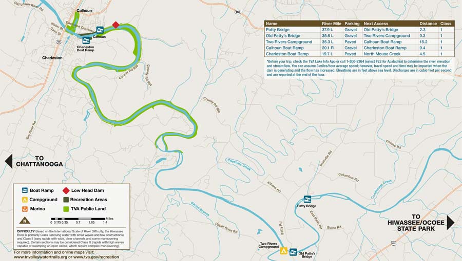
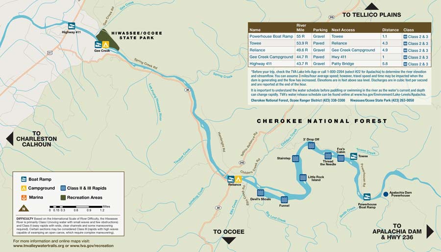
Where to Get Ocoee River Maps
The Ocoee River State Park has developed helpful, free maps of the Ocoee River. The map below is available in digital and print format. To get the print maps, visit the Ocoee River State Park office in Delano, TN, or visit any of the Ocoee Rafting Outfitters. Most of them will have print copies available at their outposts.